Why paper land records are a problem everywhere
Every country that has private land keeps some record of who owns which piece of it. In most of the world that record started on paper, and in many places it still lives there. A paper record is easy to lose, hard to search and easy to alter. When two people claim the same land, the case often comes down to which piece of paper a court believes.
Moving these records to a computer sounds simple. In practice it means someone has to read every page and type it in. For a few thousand pages this is tedious. For tens of millions of pages it becomes a project that runs for decades and never quite finishes.
The khatian
In Bangladesh, the record of rights to land is the khatian (খতিয়ান). Each khatian belongs to a mouza (মৌজা), the smallest revenue unit, and lists the owners, their shares, the plot (dag) numbers they hold, the class of each plot and its area. Land offices across the country keep them in bound volumes, survey after survey. CS, SA, RS and now BS records all sit side by side, and people still use the older ones to prove a chain of ownership.
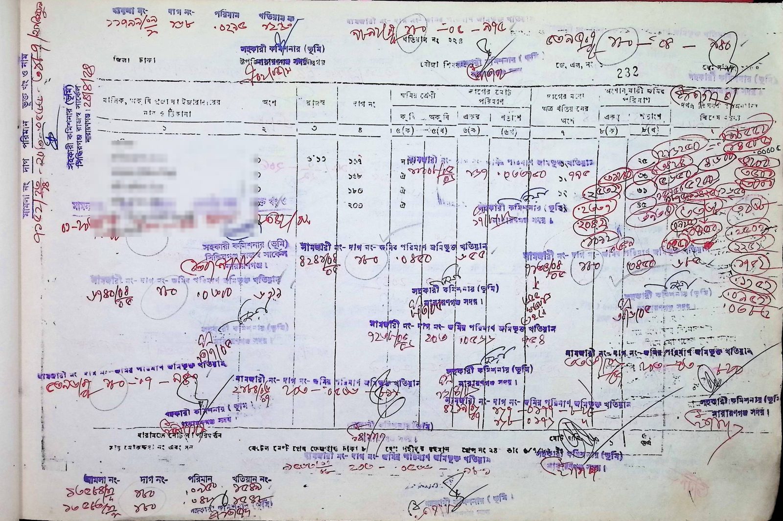
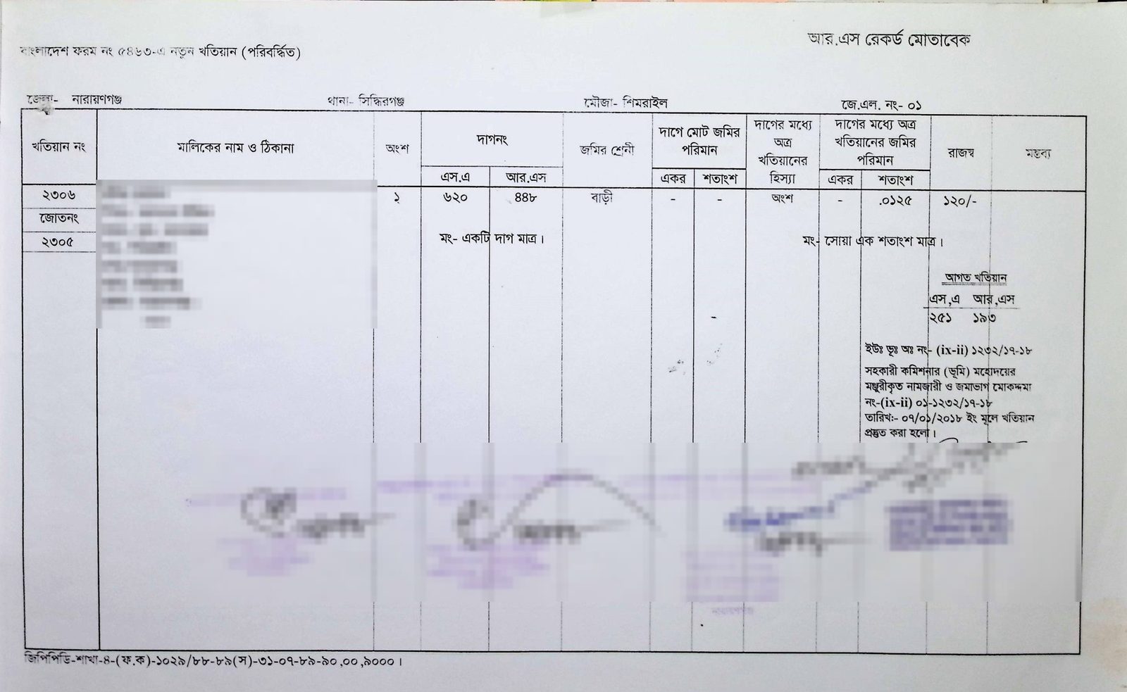
The hard part is not the printed table. It is everything people wrote on top of it. When land changes hands, the mutation is noted on the page by hand, often with a stamp and a signature, sometimes in three colours of ink and at an angle. The khatian at the top of this post has more handwriting over it than the original record. Many pages are faded, folded or torn, and the handwriting in Bengali numerals changes from one office and one decade to the next.
This matters because land is where most disputes in Bangladesh come from. A study by the Policy Research Institute for BRAC found that one in every seven households was involved in a land dispute, that land cases made up more than 70 percent of all litigation in the country, and that an average case took about eight years to settle (The Daily Star). The same study put the cost of seeing a dispute through at about 45 percent of a household’s annual income. Much of that time and money goes into finding, reading and checking old records.
What happened when we tried existing AI
Before building anything, we tested the general-purpose AI models that are good at reading documents in English. We gave them 200 khatians each from two collections they had never seen, and checked the fields that matter most.
They did badly. The best one scored 16 out of 100 on the khatian index fields and 34 out of 100 on the full record. It got the district right about half the time. However, it read the khatian number correctly only about one time in eight, and the mouza name fewer than one time in twenty-five. Some pages it could not read at all. To be fair to these models, nobody built them for handwritten Bengali land records. However, it made one thing clear to us. If we wanted this to work in a land office, we had to build a model for this exact job.
What our model does
Our model looks at a scanned khatian and fills in the record the way a trained data-entry operator would. It reads the khatian number, the JL number, the mouza and upazila, each owner and their share, every plot number under each survey, the class of land and the area.
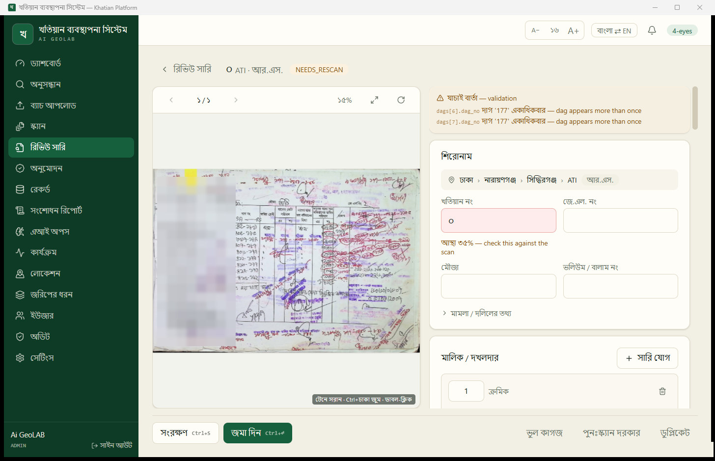
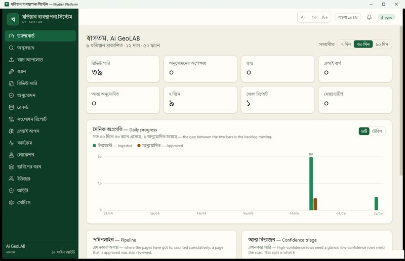
It also says how sure it is about each field. A field it is unsure of is highlighted, with a note asking the reviewer to check it against the scan. If the same plot number appears twice in one record, the screen flags it before anyone can approve the page. We believe this part matters as much as the reading itself. An operator should spend their time on the five fields that need a human, not the fifty that do not.
How well it works
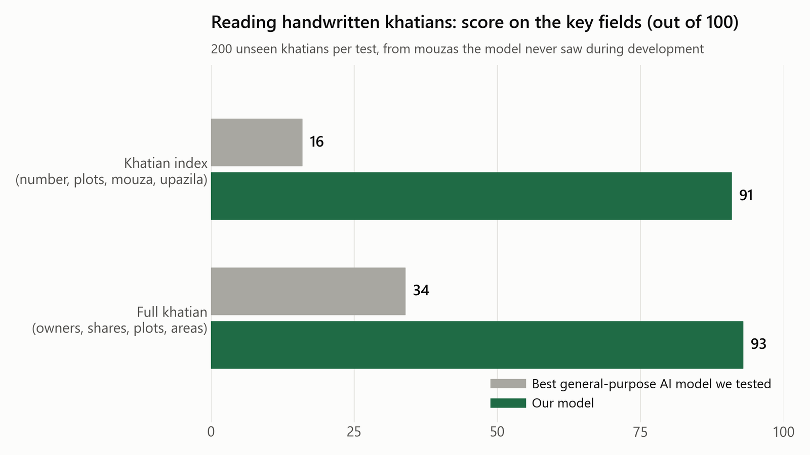
We tested the model only on khatians from mouzas it had never seen during development, so the score reflects what happens when it meets a new office’s records. It scored 91 out of 100 on the index fields and 93 out of 100 on the full record.
That is a large jump, but it is not 100. Some pages are too damaged for anyone to read with confidence, and some handwriting is ambiguous even to an experienced clerk. Hence we never let the model approve a record by itself. Every khatian it reads goes to a reviewer, and by default a second person has to approve it before the record is published. The model’s job is to make that review fast, not to replace it.
Land records are also sensitive. A khatian names real people and what they own. The whole system runs offline on one computer in the office, and no scan or record leaves that machine. We did not want a land office to have to choose between using AI and keeping its records private.
What this means for Bangladesh
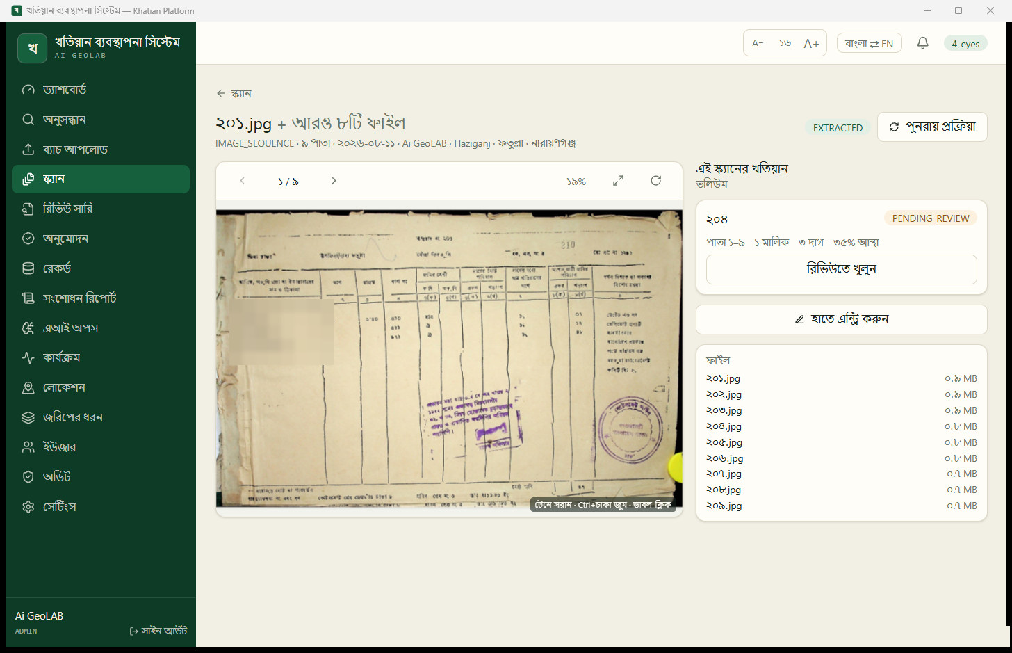
The first benefit is time. Instead of typing every record from scratch, an operator checks what the model read and corrects the few fields it flagged. Across an archive of millions of pages, we believe that is the difference between a project that finishes and one that does not.
The second benefit is that the records become searchable. Today, finding every khatian that mentions a given plot can mean pulling volumes off a shelf. Once the records are digital, a search by mouza and plot number returns every khatian that ever held it, along with the history of mutations. We believe this alone would shorten many disputes, because so much of a land case is spent establishing what the records actually say.
Why this matters for land valuation
Land valuation in Bangladesh starts from the khatian. The khatian tells you who owns a plot, how much of it they own and what class of land it is recorded as. Official land values are set mouza by mouza and class by class. For years these were the fixed mouza rates, and most deeds were registered at those rates, often well below what the land actually sold for (CPD).
In June 2025 the government announced plans to change the approach. Under the proposal, the minimum value would follow the average value of all deeds for a land category over two years, and a mouza could be split into clusters when prices inside it differ (The Business Standard). That method only works if the underlying records are clean. You need to know which plot each deed covers, what class of land it is and how large it is. A wrong plot number or a misread area puts a sale into the wrong category and moves the average.
Digitised khatians make this possible at scale. With every plot’s owners, share, class and area in one place, a valuer can find comparable plots in the same mouza, a bank can check the record behind a mortgage without sending someone to the record room, and a land office can see when the class on record no longer matches the land. We believe accurate records are the first step towards land values that people trust.
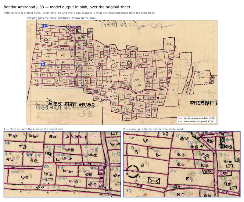
The khatian is only one half of the picture, though. It says plot 448, but not where plot 448 is. In the next post, we look at the mouza maps that answer that question, and how we taught a model to read them.