Why digitisation projects stall
Most land digitisation efforts do not fail because the technology is missing. They stall in the middle. Scanning is fast, and a scanned page looks like progress. However, a scan is only a picture. Someone still has to read it, type it, check it and publish it. Hence the scans pile up, and the searchable records that people actually need arrive slowly or never.
There is a second problem. Land records are sensitive, and the people who keep them are right to be careful. A system that sends scans to a server abroad, or lets an AI publish records without a person checking them, is a system a land office should not trust.
We built the Khatian Platform around both problems. It is a desktop application that takes a land office from a pile of scanned pages to published, searchable records, with people in control of every step.
What it does
The first three posts in this series covered three AI models. One reads handwritten khatians, one turns mouza maps into digital plots, and one outlines the land as it looks today. The platform is where those three come together, alongside the people who check their work.
From scan to record
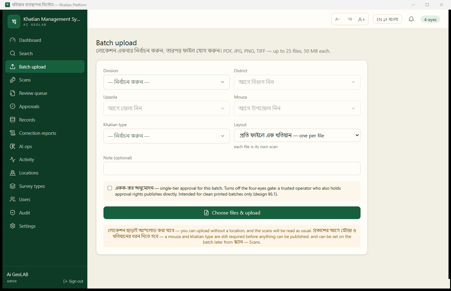
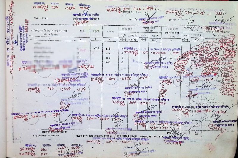
An operator uploads a batch of scans and tells the platform where they come from. The platform reads every page and places each khatian in the review queue, already filled in.
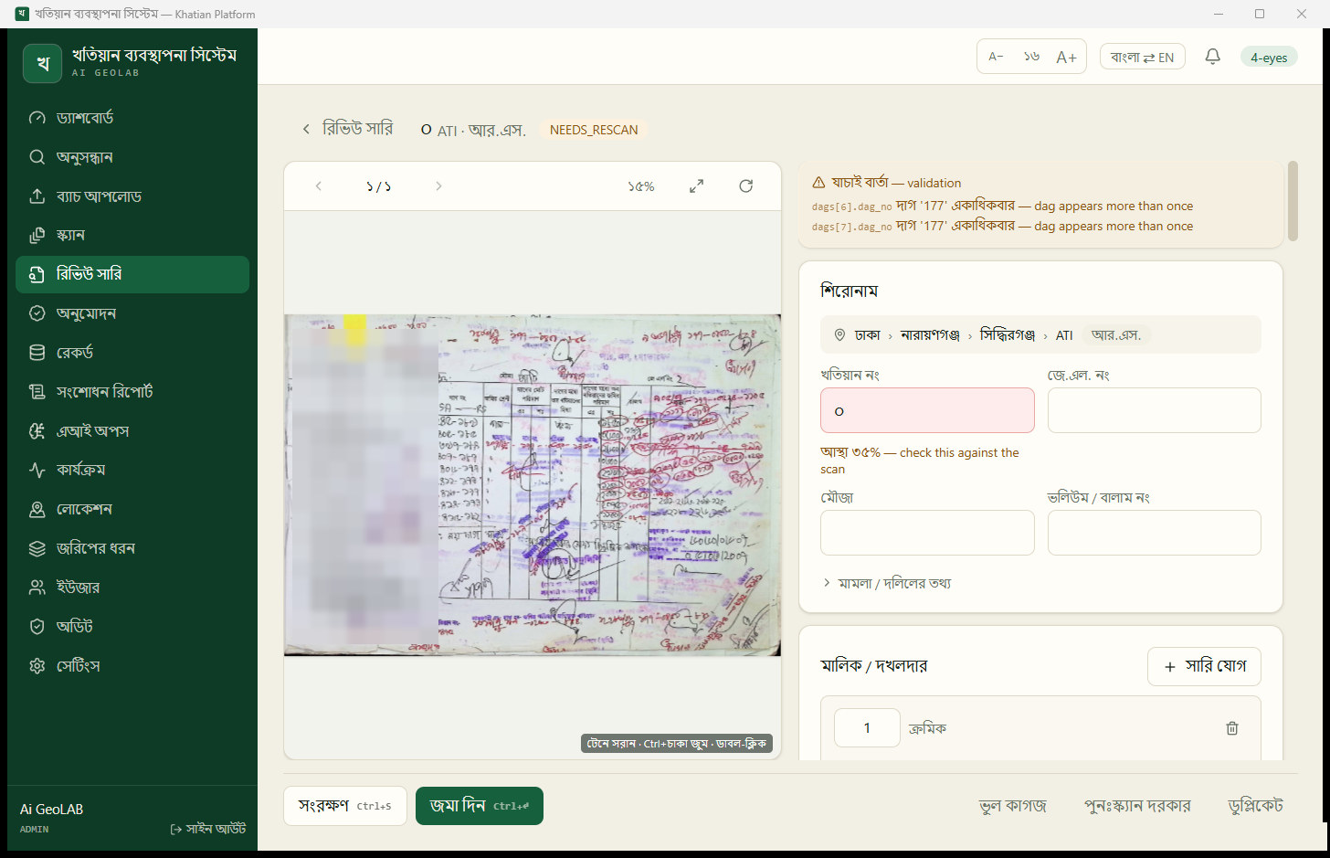
A reviewer opens each khatian, checks it against the scan and fixes what needs fixing. The fields the model is unsure about are highlighted, so the reviewer knows where to look first. If the model cannot read a page at all, it still lands in the queue for manual entry. Nothing gets lost because the AI failed.
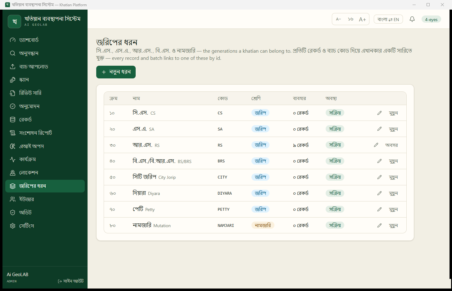
By default, a reviewer cannot publish their own work. A second person, an approver, has to sign it off. This is the same four-eyes rule that careful offices already use on paper, and the platform enforces it.
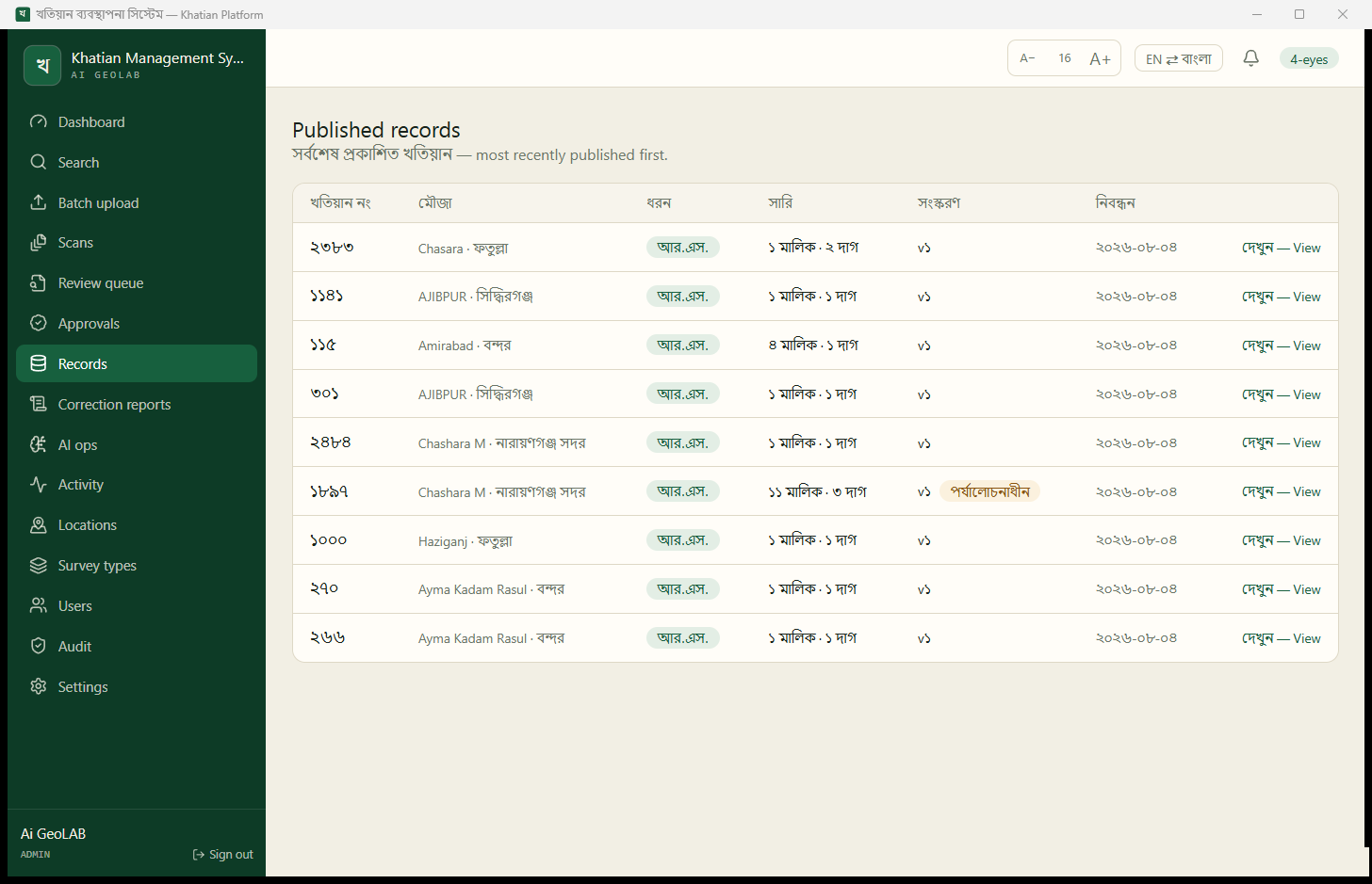
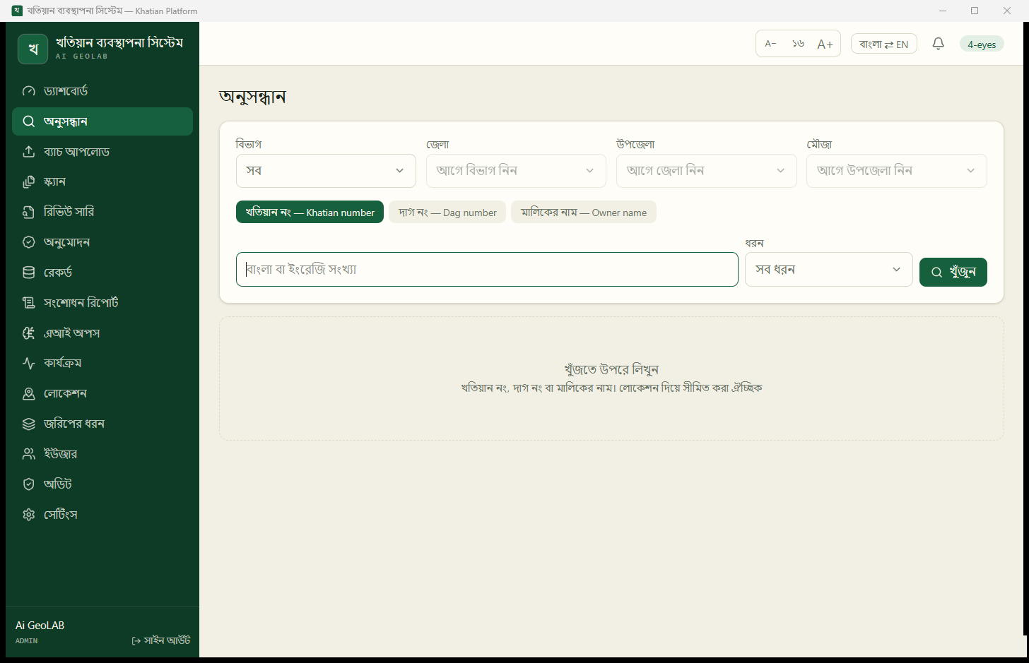
Once approved, a record is published and becomes searchable by khatian number, plot number or owner name. Every change after that creates a new version, and the old version is kept. The platform records who changed what and when. When a record is corrected, you can see what it said before.
From map to plot
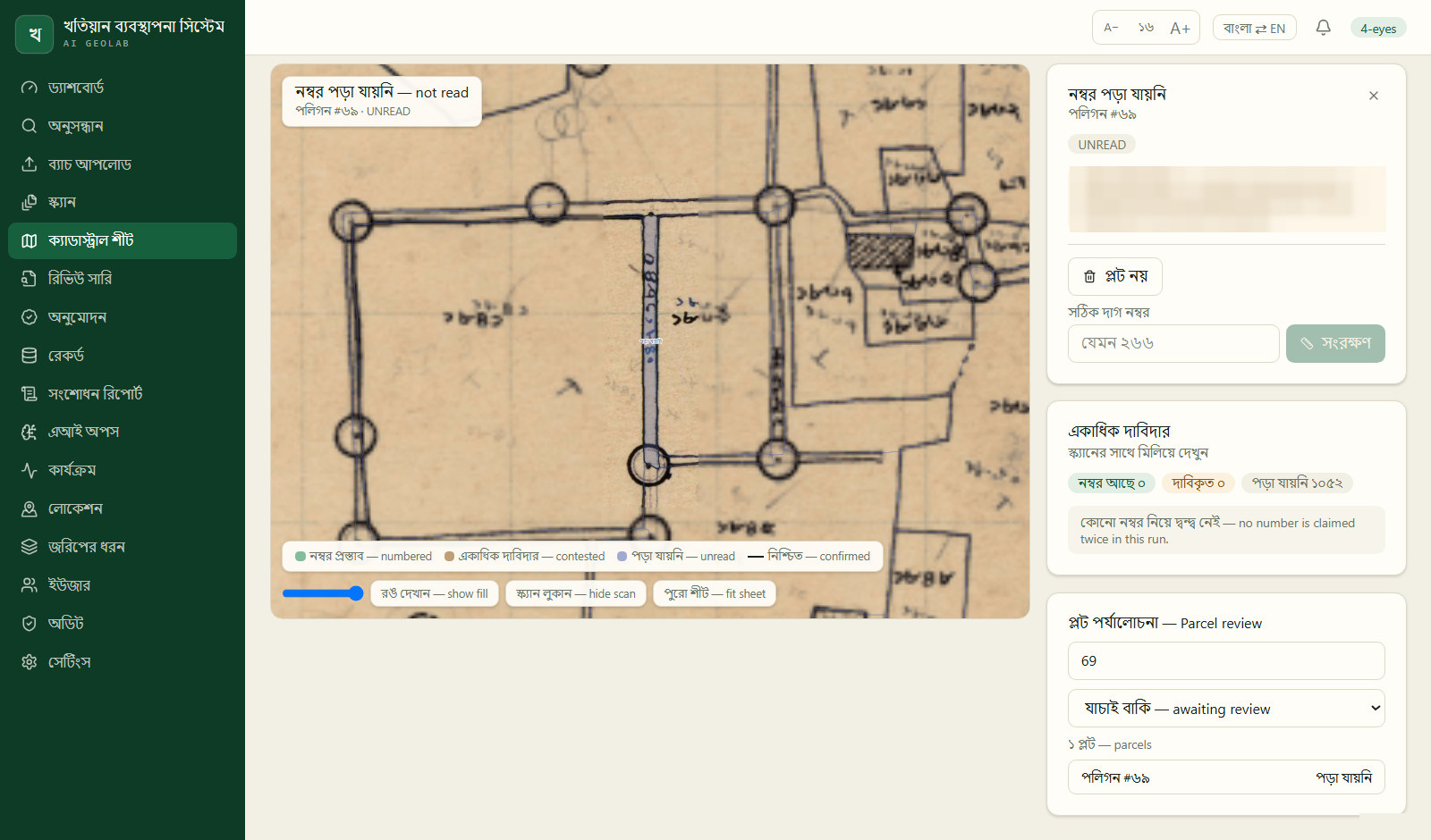
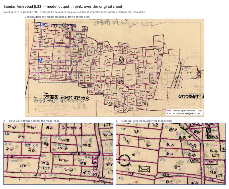
Mouza maps follow the same path. The platform outlines every plot on a scanned sheet and reads its number, and a reviewer checks the result against the scan. Once a plot has its number, a click on it shows the active khatians that hold that plot in that mouza. For the first time, the record and the map sit on the same screen.
From plot to ground
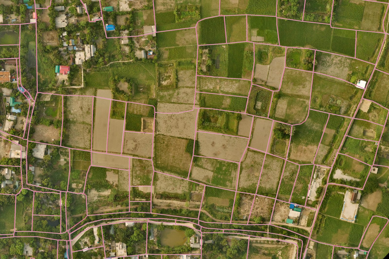
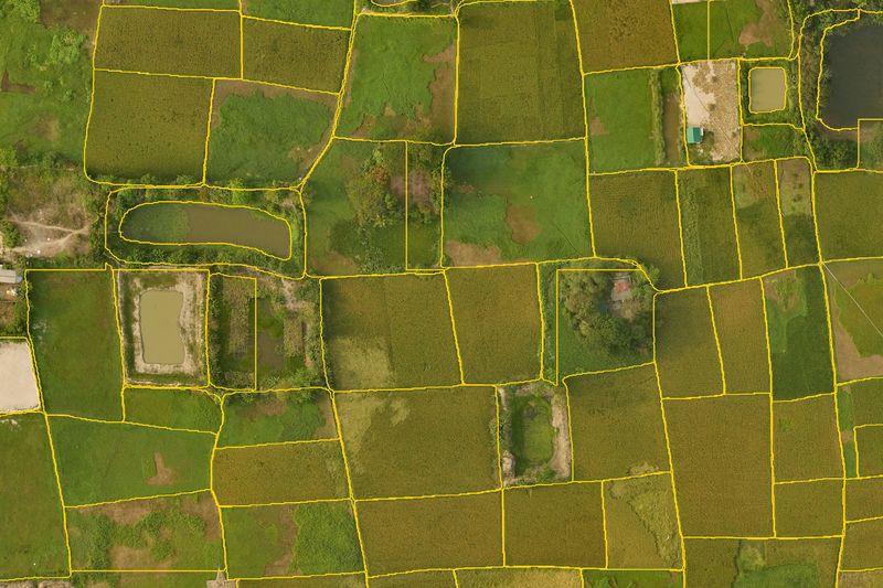
The third layer is the land itself. When a reviewer selects a plot, the platform can show the fields, ponds and homesteads our model found in the 2025 aerial photo over that ground. A plot drawn as one field decades ago might now hold three fields and a house. The platform does not treat that as an error to hide. It shows it, because that difference is exactly what a land office needs to know.
How we designed it
A few decisions shaped everything else.
It runs offline. The whole platform, including the AI, runs on one computer in the office. No scan, record or map leaves that machine. A land office in an upazila with a weak internet connection can use it as well as one in Dhaka.
People approve, not the AI. The models make proposals. A reviewer checks them, and an approver signs them off. The AI never publishes anything on its own.
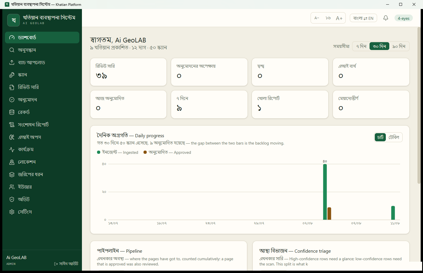
It speaks Bengali first. The interface is in Bengali, with English available at one click. Bengali and English numerals both work in search. Text size can be raised for anyone who needs it.
Everything is traceable. Each record keeps its history, each change has an author, and each AI reading is tied to the version of the model that produced it. When we improve a model, an office can tell which records were read by the old one.
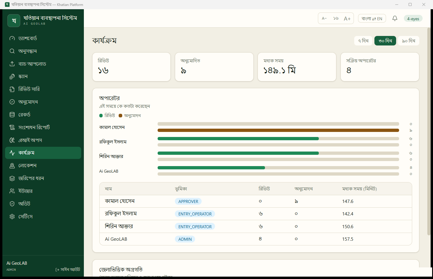
Work is visible. The dashboard and activity pages show how many records came in, how many were approved and how long reviews take. A supervisor can see where the backlog is without asking anyone.
What this means for Bangladesh
Bangladesh already has the paper. It has khatians going back over a century, mouza maps for every mouza, and since 2025, aerial photos of the land at 10 centimetres per pixel. What it has not had is a practical way to connect them.
We believe the Khatian Platform is a step toward that. A land office can turn its record room into searchable data at the pace of its reviewers, not its typists. A citizen can, in time, check their own record and report a mistake, and the correction goes through the same review as everything else. A court can see the full history of a plot instead of only its latest record. The government’s digital survey, which has started in its first 634 mouzas (Bangladesh Post), can start from clean digital copies of the old records in the places it has not reached yet.
Why this matters for land valuation
Valuing a plot well needs three answers. Who owns it, and how much of it? Where exactly is it, and how big is it? What is on it today? The khatian answers the first, the mouza map the second, and the aerial photo the third. Until now, these lived in three different places, two of them on paper.
In June 2025, Bangladesh announced plans to move its official land values toward market prices. Under the proposal, the minimum value would follow the average value of registered deeds for each land category, with mouzas split into clusters where prices differ (The Business Standard). That would be a big step away from fixed mouza rates that sat well below real prices for years. However, any new method will only be as good as the data behind it. A deed tied to the wrong plot, a plot recorded under a class it no longer matches, or a cluster drawn without a map will all move the numbers.
With records, maps and ground in one place, those problems become visible. A valuer can open a plot and see its owners, its recorded class, its area on the map and its use on the ground, on one screen. A bank can check collateral against all three. A land office can find plots whose recorded class no longer matches what is there, before they distort the next round of valuations. We believe fair land values in Bangladesh start with records that are complete, connected and checked by people. That is what we built this platform to do.