In Bangladesh, the answer to “who owns this land?” is rarely one document. It is a stack: a khatian (record of rights) from each survey, the map of the mouza (revenue area) where the land lies, deeds, and the mutation records that brought the khatian up to date. A study by the Policy Research Institute for BRAC found that land cases made up more than 70 percent of all litigation, and that the average land case had been pending for about eight years (The Daily Star).
This guide explains what is in the stack and where each piece came from. It does not cover the Chittagong Hill Tracts.
What a khatian is
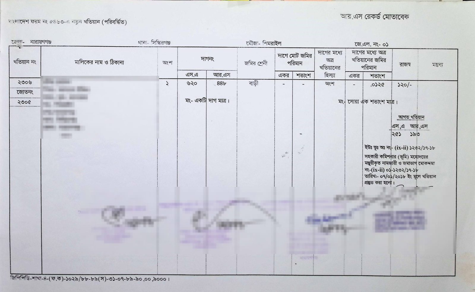
The khatian (খতিয়ান) is the record of rights (RoR) to land. Each khatian belongs to one mouza (মৌজা) and has its own number. It lists the owner’s name, father’s name and address, the dag (plot) numbers, the class of land, the owner’s share and the annual rent (The Daily Star Bangla).
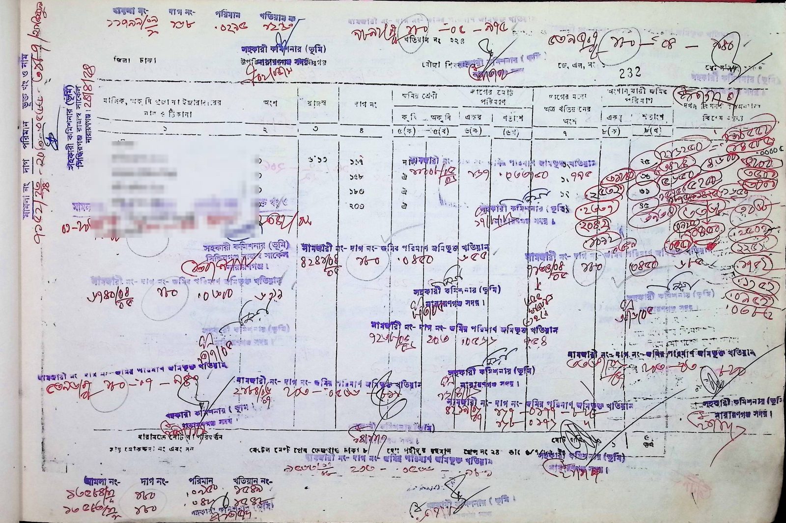
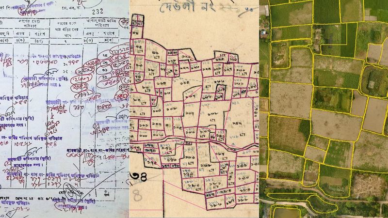
Layouts vary. On the khatian above, the header gives the district, mouza, JL (jurisdiction list) number and khatian number. Beside each dag number, the columns give its class of land, its total area, this khatian’s share of it and the area that share comes to.
A khatian is not, on its own, a document of title, though it is evidence of title and possession (IIUC Studies). By law, every entry in a record of rights prepared or revised under section 144 of the State Acquisition and Tenancy Act is presumed correct until it is proved incorrect (s.144A).
Mouza, JL number and dag number
A mouza is a defined area for revenue purposes, and each one has a JL number (The Daily Star Bangla). Within a mouza, every plot has a dag (দাগ) number.
According to the Department of Land Records and Surveys (DLRS), amins (field surveyors) first measure every plot and draw it on the mouza map, a stage called kistwar. Later, at khanapuri, they give each plot its dag number and write the owner’s details into the khatian (DLRS). The Settlement Department’s Technical Rules (1957 edition; DLRS publishes a Bengali translation) have plots numbered serially from north-west to south-east (Technical Rules, 1957).
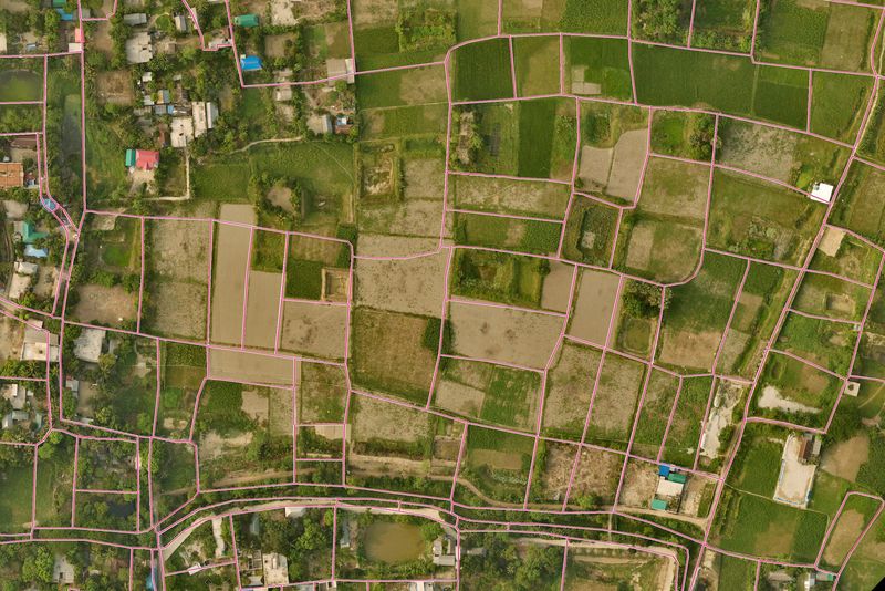
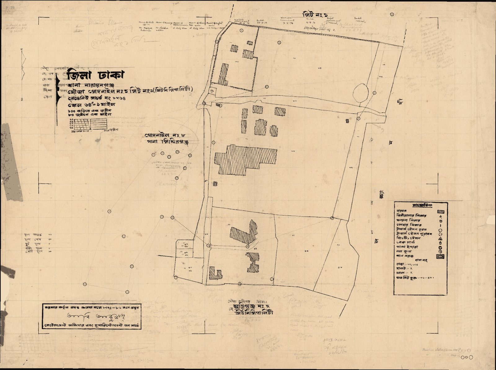
So the khatian says which plots an owner holds, and the map shows where they are, their shape and their neighbours. Mouza maps are usually drawn at 16 inches to the mile (Banglapedia). Town sheets are often drawn at 64 inches; the sheet at the top of this post, a municipal sheet from Godnail, is one. Our post on turning old mouza maps into digital parcels shows how we read sheets like it.
How a survey makes the record
Rule 27 of the East Bengal Tenancy Rules 1955 sets the usual stages of a survey, from traverse survey through khanapuri, bujharat (local explanation) and attestation to final publication (Tenancy Rules). At bujharat, each owner receives a copy of the draft khatian, the math porcha (মাঠ পর্চা, field porcha), and can dispute it. The draft is later open to the public for 30 days (DLRS). After final publication, a challenge goes to a Land Survey Tribunal, normally within one year (State Acquisition and Tenancy Act, s.145A).
The survey generations
CS (Cadastral Survey). The first plot-by-plot survey, with records made under the Bengal Tenancy Act 1885 and maps under the Bengal Survey Act 1875 (Banglapedia). DLRS says it began in Ramu thana (now Ramu upazila), Cox’s Bazar, in 1888 and ended with Dinajpur in 1940. Greater Sylhet, then part of Assam, was not covered (DLRS).
Early revisions. Greater Chittagong, Faridpur and Bakerganj were revised after the CS, the last finally published in Bakerganj in 1952 (DLRS).
SA (State Acquisition). The State Acquisition and Tenancy Act 1950 provided for the state to acquire the interests of rent-receivers, such as zamindars (Laws of Bangladesh). DLRS dates the SA from 14 April 1956 to 1963 and says it was not a field survey. District staff wrote its khatians at the zamindars’ offices, from the zamindars’ own registers (DLRS).
RS (Revisional Survey). A new revisional survey began in Rajshahi district in 1965–66. DLRS’s history page says it is still under way in the Dinajpur, Rangpur, Bogura, Sylhet, Khulna and Barishal zones (DLRS), though that text may predate the September 2023 halt described below.
BS/BRS. The Bangladesh Survey (BS), also called the Bangladesh Revisional Survey (BRS) (The Business Standard), produced the BS and BRS khatians now in use; bdnews24 dates its start to the 1990s (bdnews24). BS was still under way in September 2023, when the land minister ordered old-method surveys stopped in favour of the digital survey (Ittefaq). The next day he said this covered ongoing and recent surveys, not completed ones (Prothom Alo).
City Jorip. Jorip (জরিপ) means survey. The Mohanagari (city) survey drew new maps and records for Dhaka’s metropolitan mouzas only (DLRS).
Diyara. Diyara (দিয়ারা) surveys cover land lost to river erosion and new land (char) thrown up by rivers, under a permanent settlement office set up in 1963 (DLRS). If lost land reappears in place within 30 years, the original tenant’s rights survive, though the Collector takes possession first and re-allots it, keeping the tenant’s total holding within 60 standard bighas (State Acquisition and Tenancy Act, s.86).
Why people still use the old records
Each field survey revised the mouza map (drawing a new one or correcting the old sheet), gave the plots dag numbers and wrote new khatians (DLRS). So the same ground can carry a different dag number, in a different khatian, in each generation. The SA records were not made on the ground at all. And because a khatian alone is not a document of title, anyone who needs to know how land reached its present owner, whether a buyer, a bank or a court, follows it back: from the latest khatian, through the mutations and deeds behind it, to the RS, SA and CS records.
Even a new survey starts from the old records: at khanapuri, the amins check the owner’s existing records, deeds and possession before writing the new khatian (DLRS).
Mutation (namjari)
Between surveys, the record is kept current by mutation, or namjari (নামজারি). By law, the Collector must record changes of name after transfer or inheritance, as well as subdivisions and amalgamations (State Acquisition and Tenancy Act, s.143). Except for bequests and court or certificate sales, a transfer of a holding must be made by registered deed (s.89).
In practice, the new owner applies to the Assistant Commissioner (Land). On approval, the land is struck off the old holding (jote), a new holding is created in the applicant’s name and a new khatian is opened (Prothom Alo).
Where online services stand
Mutation. Applications are made online at mutation.land.gov.bd. A Tk 20 court fee and a Tk 50 notice fee are paid on application, and Tk 1,100 after approval (bdnews24), the amounts still listed in October 2026 (Ministry of Land). Since October 2022 they can only be paid online (The Financial Express). The UN, giving e-mutation a Public Service Award in 2020, reported that it had cut the time for a mutation from 60 days to 28 (UN DESA). Delivery has lagged: in July 2025 the land services website showed an average of 36 days (The Business Standard).
Khatians and maps. Copies of khatians and mouza maps are ordered through the Land Records and Maps service (dlrms.land.gov.bd), formerly e-porcha. You choose the survey type, then search by khatian number, owner name or dag number (bdnews24). As of October 2026, an online khatian copy costs Tk 100, and a certified copy Tk 100, plus Tk 40 if sent by post (Ministry of Land).
The digital survey. The Bangladesh Digital Survey was piloted in Patuakhali in August 2022 and launched in Chattogram on 6 August 2023, with a first phase of 634 mouzas (Prothom Alo; Bangladesh Post). In October 2026, The Business Standard, which dates the digital survey programme to 2012, reported that only 274 of the country’s 58,590 mouzas had been surveyed digitally (The Business Standard).
Scanning has gone further. By 2017, about 65 lakh (6.5 million) khatians and 18,500 map sheets had been scanned and indexed (The Daily Star). A scan is only a picture, though.
Where our work fits
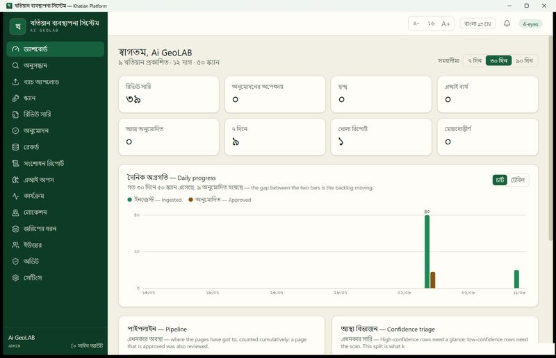
The Khatian Platform is our desktop software for taking a land office from scanned pages to published, searchable records. It supports eight types of record, including the CS, SA, RS, BS/BRS, City Jorip, Diyara and mutation (namjari) khatians described above.
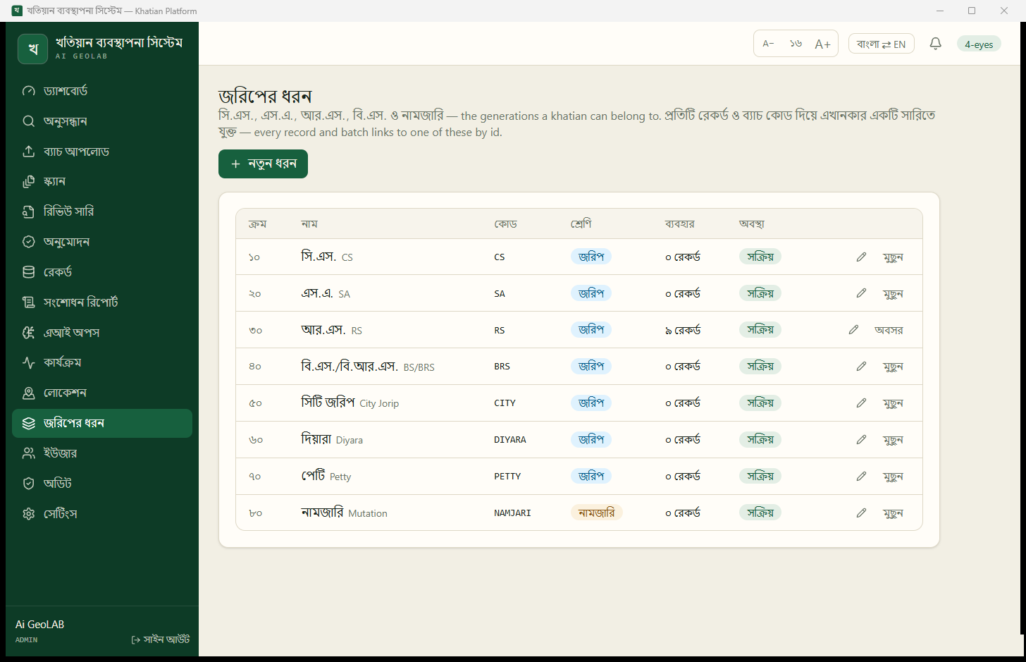
Our model reads each khatian, including every plot number it lists under each survey, and a person checks every record before it is published (reading handwritten khatians). Published records can be searched by khatian number, plot number or owner name, narrowed by division, district, upazila and mouza. On a digitised mouza map, clicking a numbered plot shows the active khatians that hold it in that mouza (the Khatian Platform). We believe that keeping every generation in one place, checked by people, turns a trip to the record room into a search.
Why this matters for land valuation
Valuing a plot well needs three answers: who owns it and how much of it, where exactly it is and how big, and what is on it today. The khatian and the mouza map answer the first two. A valuer comparing plots, or a bank checking the record behind a mortgage, needs the right khatian from the right generation, matched to the right plot. See how this supports valuation, or get in touch.
Related posts